System Positioning
The real-time site personnel positioning system integrates three positioning technologies, showing every site worker's position on the map in real time, combined with electronic fence, lost-contact detection and emergency SOS, so site managers, safety officers and headquarters managers always know where everyone on the site is, effectively preventing industrial accidents and speeding up emergency response.
Three Positioning Technologies
Flexible configurationPeople only need to install the app, with no extra hardware to buy. Suited to quick deployment and small or medium sites with limited budgets; works best when outdoor GPS signal is good.
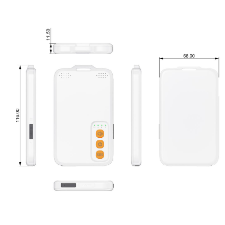
UWB (ultra-wideband) technology provides sub-meter positioning accuracy unaffected by metal structures, suited to basements, tunnels, indoor floors and other places GPS signals cannot reach.
The smartwatch integrates GPS positioning and heart rate monitoring and triggers an alert automatically when abnormal heart rate or prolonged stillness is detected, suited to personal protection needs for solo work or high-risk environments.
| Technology | Positioning Accuracy | Indoor Use | Hardware Needed | Best Suited For |
|---|---|---|---|---|
| Phone app GPS | 3–5 meters | ❌ Mainly outdoor | Phone only | Open sites |
| UWB badge | 30 cm | ✅ Best | Base stations + badges | Basements and tunnels |
| Watch GPS | 3–5 meters | ⚠️ Limited | Smartwatch | High-risk solo work |
Core Safety Functions
Every person's position is marked in real time on the site plan or satellite map, so managers see the personnel distribution across the whole site at a glance.
Draw hazardous areas on the map; when someone crosses the boundary a sound and light alarm triggers immediately and LINE / Teams notifications are pushed, preventing unauthorized entry.
Set a response time limit; failure to respond in time triggers an alert automatically, so accidents in remote or underground areas do not go unnoticed.
Automatically records when each person enters and leaves the work zone, replacing manual sign-in and serving as a basis for working-hour calculation and safety management.
In an emergency a person presses SOS, and the system immediately pushes the location to the site manager and safety officers, shortening rescue time.
Tallies dwell time and distribution hotspots by area, helping identify dangerous crowding behavior and construction efficiency bottlenecks.
Query the movement track of a specific person or time period; after an accident the events can be reconstructed quickly as a basis for investigation and review.
Monitors the wearer's heart rate in real time and triggers an alert automatically when abnormal heart rate (too high / too low / stopped) is detected, suited to hot or high-stress work environments.
System Integration
Positioning data integrates directly into the 4S360 security platform, sharing accounts and department structure with the personnel access control, attendance and visitor systems.
Events such as electronic fence boundary crossing, SOS calls and lost contact are pushed in real time to designated LINE groups or Teams channels.
Real-time personnel positions and statistics show on the site office information board, so managers entering the site office see the current situation at first glance.
Applications
Technical Specifications
Wondering which positioning technology suits your site best?
Based on your site size, work environment (indoor / outdoor / underground) and budget, we recommend the best positioning solution.